On the way to Cathedral Gorge, I stopped for a night at Pahranagat National Wildlife Refuge. Camping was free and there were several nice campsites right on the water.
It was a nice change of scenery after Valley of Fire, and Thistle and I had a chance to get the boat wet.
There were several Eared Grebes.
Can you see my campsite?
Great Blue Heron
More grebes.
I was the only camper there until late afternoon when a couple more came in.
But it was too hot to stay long without hookups, so we traveled on. We stopped for a stretch break in the town of Caliente (which means "hot") located in an ancient caldera. It's a pretty little well-landscaped town.
Caliente's historic railroad station.
Driving into Cathedral Gorge State Park, a pair of Desert Spiny Lizards crossed the road. I think this is the male.
I had a nice shady site with electric hookups, so I could leave Thistle in the AC while I explored.
Volcanoes, earthquakes, water, and erosion created the spires and buff-colored cliffs of Cathedral Gorge.
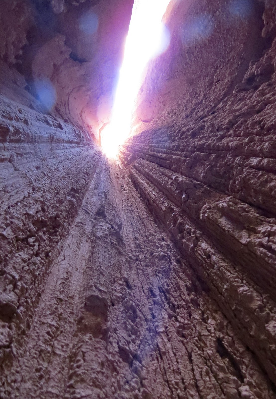
I explored the narrow slot canyons cut deep into the old muds that millions of years ago were at the bottom of a lake.
The variations in layers of rock and sediment tell the story of fluctuating lake levels and the flow of rivers that deposited silt and volcanic ash.
The ash came from the Caliente Caldera Complex that we drove through on the way here.
Looking up, you can see how deep we are in the formations.
These formations are still undergoing erosion. I wouldn't want to be in here during a heavy rain...you can see the mud flows.
It is very cool inside the canyons...like a cave.
There are many of these slot canyons, but they all look about the same, so I did not go into all of them.
Close up of the wall of the canyon.
Pigeons like to perch on and soar above the spires.
Cathedral Gorge became one of Nevada's first four state parks in 1935.
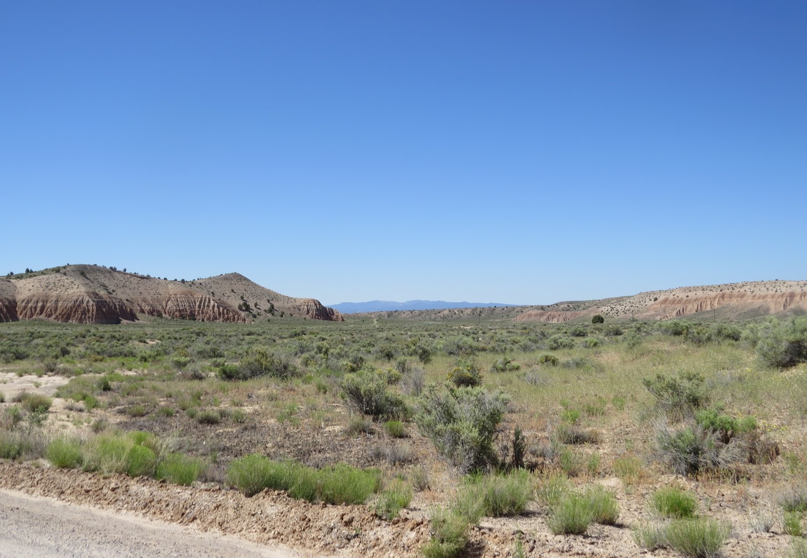
The valley outside is amazingly green, in contrast with the canyon walls.
I didn't try to squeeze through there.
Some canyons had side canyons...creating a maze. It occurred to me that one could get lost in here.
This large column has collapsed.
Follow the light to find your way out.
A blooming tree.
There are several trails here. The first afternoon I just explored the "Caves" (slot canyons) area. It was too hot to hike the trails. In the early morning, Thistle and I hiked the trail to Miller Point before we left.
Wren
Mud flows...
The original picnic facilities built by the CCC in the 1930s are still in use today. The stone water tower seen here, provided water to the picnic area, but it is no longer in use, and the well has been capped.
Cactus are blooming here.
The picnic area is behind those spires.
The CCC built the ramada and stone fireplaces. There are more slot canyons in this area.
I didn't go any farther inside this one when I noticed a 2x4 holding up a large column.
Really? There are no danger or warning signs anywhere.
The view from there.
Back in the RV, this fellow was peeking in our window from the tree outside.
The view behind the campground.
These pictures are from our early (6 a.m.) morning hike. This is the group camping area.
The black-tailed jack rabbit is hoping no one can see him. Thistle didn't.
We hiked from the campground to Miller Point Overlook.
This rest room facility built by the CCC is no longer in use, but replaced by a more modern facility. I like how the original building blends in with the background.
The Miller Point Trail.
Early morning sun on the formations. We did this hike very early while it is still cool.
Entering the gorge.
There are stairs involved.
The trail climbs out of the gorge to a viewpoint on top. Do you see it?
The ramada at Miller's Point was also built by the CCC.
Follow the wash to the first set of stairs.
Above the wash, the trail follows this ridge and across a little bridge.
I could quickly see that these are not dog-friendly stairs.
So Thistle got carried up them.
He managed the wooden steps fine.
Looking back into the gorge.
There's a reason those railings are there. The trail goes between them, and there are big chasms on both sides.
Almost to the top we are greeted with this sign:"Caution, use trail at own risk." Now they tell me.
These stairs were not as bad, but Thistle opted to be carried here too. Don't want his little toes caught.
We made it!
Miller's Point
And for those who don't want to hike...you can drive up here!
The view from Miller's Point. The trail continues to another viewpoint called Eagle Point, but I forgot (gasp) to bring water, so we turned back. In my defense, it was very cool when we started out, so I wasn't thinking. Don't ever take a hike in the desert without water.
Carrying Thistle down the stairs was easier than going up.
Another couple had the same idea I did...start early. You can just see them below.
You can see the drop offs on both sides of the rails. Eventually it will erode to the point they will have to build a bridge.
The sun is higher and reaching farther into the gorge.
The gorge
Back at the picnic area. Ravens are roosting on the ramada...waiting for the next picnic.
They like to roost on top of the spires too.
The trail back to the campground. And then we moved on...heading for cooler climates.