On Wednesday, I drove about 40 miles to the northwest corner of Yosemite, Hetch Hetchy Valley. The drive over was very scenic. This is a view from Big Oak Flat Road.
Cascade Creek is well-named.
Hard to tell, but from this viewpoint I got my first glimpse of the Hetch Hetchy Reservoir Dam.
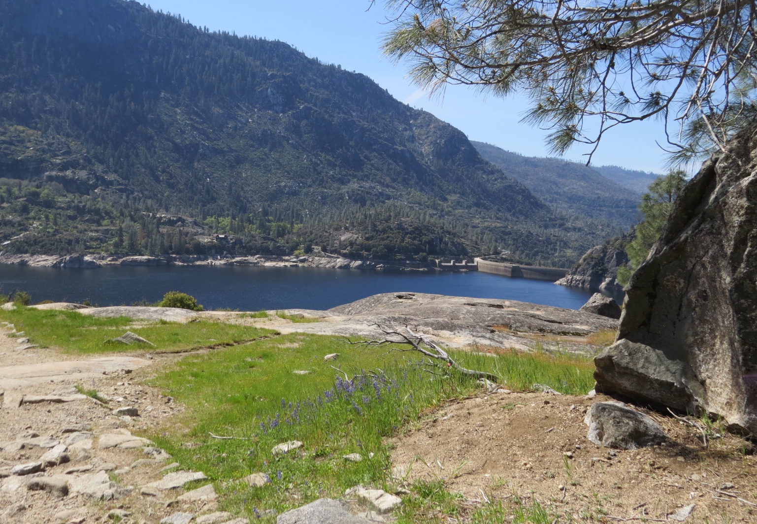
Hetch Hetchy Reservoir.
Our hike will take us to two waterfalls emptying into the reservoir. You can see the top of Tueeulala Falls on the left, and the base of Wapama Falls on the right.
Below the dam, water being released into the Tuolumne River creates a rainbow.
You cross the top of the dam and go through a tunnel to access the trail.
There's a lot of water in the tunnel, but if you hug the wall on the right, you can keep your feet dry.
The trail follows the shoreline of the reservoir.
Not sure what this colorful plant is....looks like a type of fungus, maybe.
The river and reservoir provide a clean source of drinking water for the city of San Francisco and the surrounding area.
In this picture you can see Tueeulala Falls on the left and the top of Wapama Falls on the right. They are two of North America's tallest waterfalls, plummeting over 1,000-foot granite cliffs.
The name Hetch Hetchy is derived from the Miwok Indian word, hatchhatchie, which means, "edible grasses." That describes the valley before it was flooded by the reservoir. It was home to Native Americans for more than 6,000 years.
The trail involves some moderate up and downhill hiking.
This small waterfall next to the trail has created a lovely hanging garden on the cliff walls.
Flowers and plants growing in the crevices where the water flows.
The little waterfall.
Hanging garden.
As early as 1882, Hetch Hetchy Valley had been looked at as a potential site for a reservoir. John Muir led the the effort opposing the dam, wanting to keep the valley untouched. It was after the 1906, earthquake and fire that Congress authorized the construction of the dam to help relieve the water shortage in devastated San Francisco.
I began to see many wildflowers and butterflies.
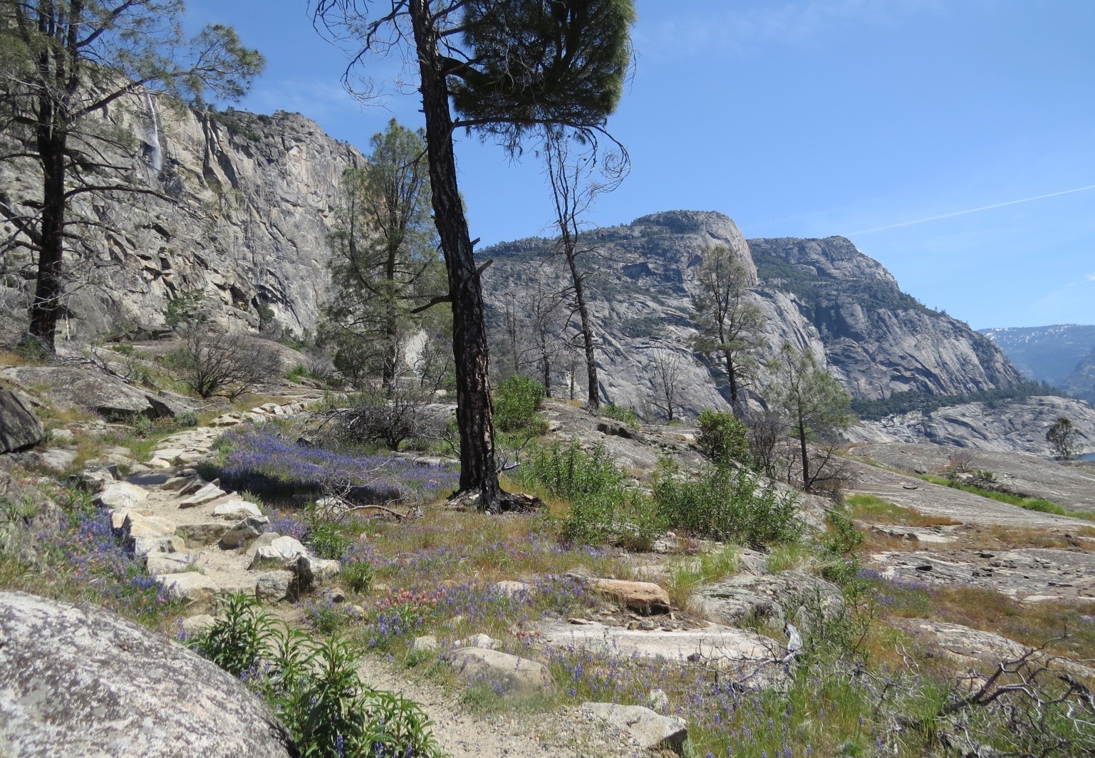
The trail opens up to a flat meadow-like area.
I learned a new wildflower....Harlequin Lupine. They grow among the normal blue ones.
Harlequin Lupine
God's flower arrangement.
The trail continues, now high above the reservoir.
This is another new wildflower for me, called Stonecrop. (I know this because there was an interpretive sign with pictures of the wildflowers in the parking lot.)
I'm not sure what this flower is.
Butterflies liked the flowers, but they were also after something in the soil.
We are getting closer to Tueeulala Falls.
Both butterflies and bees are after something in the soil here.
They were very busy.
A downhill section of the trail.
Another view of the valley.
More wildflowers.
There's just a thin layer of soil covering the bedrock, but it is apparently an ideal habitat for wildflowers with all the spring run-off.
Tueeulala Falls cascades down the rock face, and spreads out into several streams when it gets to the flatter area near the trail.
We have to cross a couple of those streams from the falls.
Another place to cross.
I named this part of the trail, "Lupine Lane," as lupines border both sides of the trail.
Lupine Lane
Bring lots of water, because it starts to get hot out on the rocks in the sunshine.
You can see Hetch Hetchy Dome on the left and Kolana Rock on the right of the reservoir.
That is the top of Wapama Falls.
Wapama Falls, but wait for the rest!
The trail enters a shady area. I was glad.
A good place to stop and rest, drink water and eat a snack.
Then we start down the final descent to the base of Wapama Falls.
The trail took me a lot longer than it would have because I got distracted by all the views, wildflowers and butterflies.
Small streams cross the trail along here.
Another shady patch. Trees grow near the flowing water.
Switchbacks
Now you can see where the falls empty into the reservoir.
There's a bridge across the base of the falls. I didn't bring my poncho, so prepare to get wet.
I tried to get a photo before my camera lens was covered with droplets.
Below the bridge.
But then I see that there are two more bridges, crossing two more cascades.
Looking back at the first bridge and the lower falls you see from the dam.
What you can't see from there is that the falls split into three separate cascades as it falls into the reservoir.
This is from the second bridge.
And the third bridge and cascade.
This one empties into the reservoir in this direction.
Pretty cool waterfall!
You dry off pretty quickly as you hike back through the sunshine.
Harlequin Lupines
Stonecrop
This was a viewpoint from the highway on the way back to Yosemite Valley. You can see Half Dome in the distance.
Zoomed in...
The Wapama Fall Trail was 5-miles, round trip.