My first trip into the National Park only made it as far as the foothills...I found a day's worth of adventure there.

First I stopped at the Foothills Visitor Center to get information and trail maps.

View of the Kaweah River. You can also see snow-capped Alta Peak (11,204') on the right and Moro Rock on the left in the background.

A stop at Tunnel Rock. The highway used to go under the rock, but vehicles have too high a clearance these days, so there is a parking area and you can walk through it.

Alta Peak

I found a trail that led down to the Kaweah River and some waterfalls.

Kaweah River.

Two miles beyond Patwisha Campground is Hospital Rock, where an Indian village was located in the 1800s. This story board explains how it came to be named Hospital Rock. See the following pics to learn more:

It began with Hale Tharp's visit to the village in 1858.

Interesting cure...

Sad fate for many of the Indian tribes in North America.


I started out on a trail behind the sign to see Hospital Rock...turned out to be the wrong trail.

But, hey, there's never a wrong trail, is there?

This one led to a beautiful view of the river and highway. Later I found out it continued back to the campground, but I turned back to the parking lot here.

Here's a better view of Moro Rock from the parking lot. There is a trail and stairway to the top, which was tentatively in my plans.

People on the top of Moro rock. Unfortunately, I didn't have enough time to do that climb...another trip.

I found Hospital Rock on the other side of the highway.

The red-stained rock holds examples of local Native American Pictographs.

Stairs lead to the pictograph viewing area.

There's a small rock shelter below.

Pictographs.

Across from Hospital Rock is a huge boulder with grinding holes where the Potwishas ground acorns into flour.

The backside of Hospital Rock has a large shelter that likely served as the "hospital."

You can see the opening to the smaller shelter located on the other side.

This larger shelter looks out over the river below.

There is also a trail down to the river. It is paved part of the way.


Toward the bottom there are huge boulders to negotiate around and through.

You can see the river from here.

But to get there you have to climb under some boulders.

The river is strewn with huge boulders.

There is a small rock shelter to the right of the boulder tunnel we just came under.

This opening leads to another trail down to the large pool below the falls.

In the summer I imagine it is a popular swimming hole. Note the eye bolt that I'm guessing ropes are attached to to make it easier to get up and down the steep stairs.
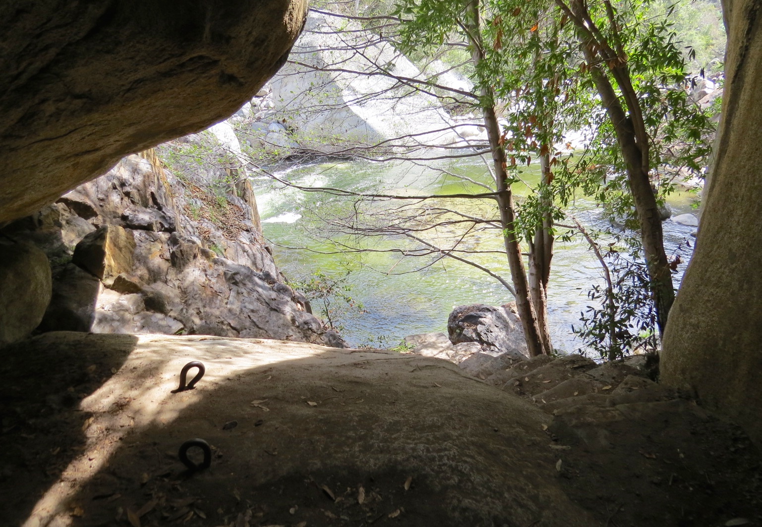
I decided not to go down there. Too cold for swimming today.

Other stone steps lead to this viewing area for looking down on the falls and the pool below.

The large pool below the falls, and more falls beyond. The river is high and flowing swiftly this time of year.

The falls above the pool.

This part of the trail leads to the swift-flowing water above the falls.

Signs warn you about the dangers of falling in. Drowning is the #1 cause of death in the Park.

The water flows around and under the huge boulders.

A lady offered to take my picture.

Colorful rocks worn smooth by the flowing waters.


There are two large potholes created by swirling water. The one on the right has grass growing in it. You can see where water flows into the river from both.

Steps leading back up to the highway.

Interesting tree with 5 large branching trunks.

That was enough adventure for one day. It takes an hour to just get this far from the campground. The next day I drove right past all these places to get to the "big trees."

Meanwhile back at the campground, Thistle was waiting for me. We took a long walk as evening shadows fell.

Western Meadowlark.

Thistle loves to watch the ground squirrels.

This quiet scene was before the Easter weekend, lol.
