View of Roosevelt Lake as you descend into Tonto Basin north of Globe, AZ.


The Apache Trail follows the Salt River eastward past Apache Lake and through the Superstition Mountain Wilderness.

Roosevelt Lake Bridge spans the river just below the dam. It was built in 1987 to divert traffic from the top of the dam so renovations could be made on the dam itself. It is the longest two-lane, single-span, steel-arch bridge in North America.

The backside of Roosevelt Dam.

This picture shows what the river looked like before the dam was built and has some information about the dam.
 We continue past the dam up Alchemy Canyon, named for an Apache Scout who was awarded an Indian War Medal of Honor in 1875.
Notice the Saguaro on the mountainside. This part of Tonto National Forest is not about trees.

Just past the dam, the road becomes dirt as it snakes along the Salt River.

The 42-mile road connects the communities of Roosevelt Lake with Apache Junction, just east of Phoenix.

It was originally constructed so that supplies could be hauled to the site of the Roosevelt Dam, and follows an aboriginal route used by ancient people.

This 38-mile segment designated as a scenic byway winds its way through some of Arizona's most spectacular scenery.

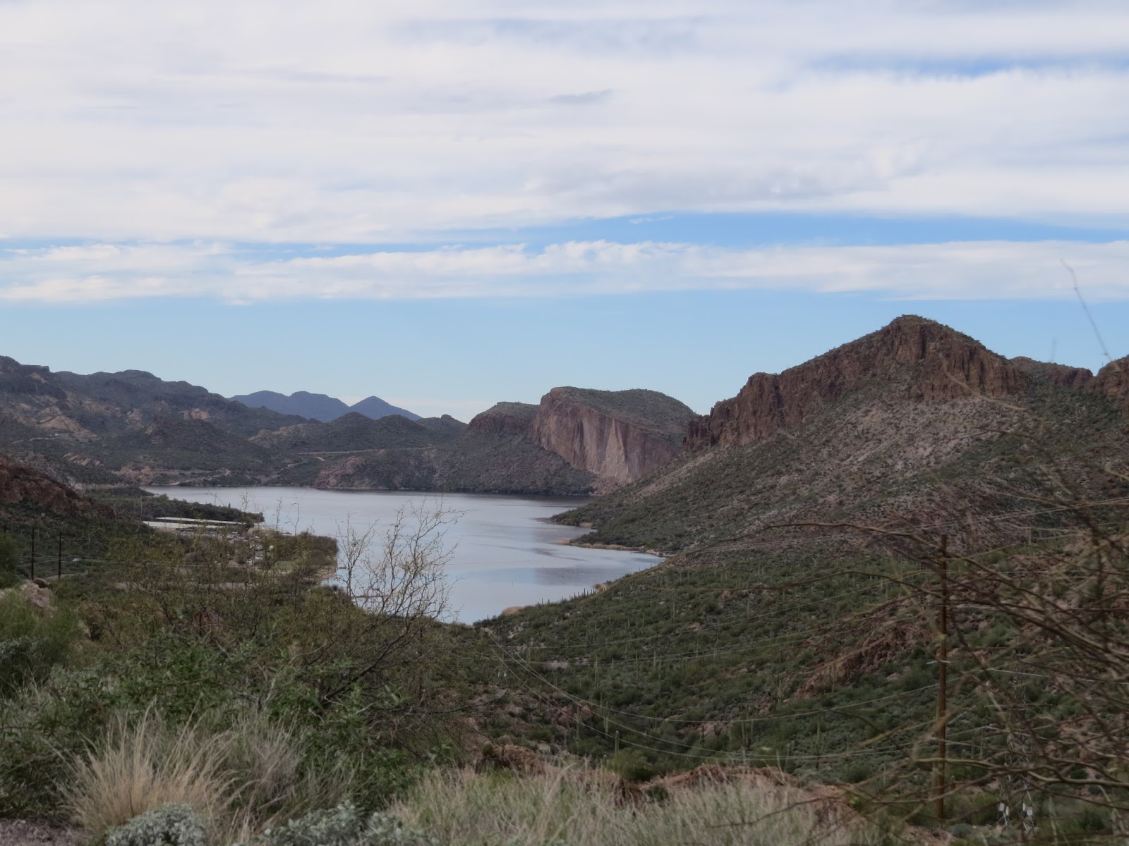
The river begins to widen as we approach Apache Lake.

The colors are awe-inspiring.

There are places along the river where camping is allowed. Below is called Three-mile Wash Recreation Site.

The lake is popular with fishermen.

And birds...these are Grebes.....

Eared Grebes, I believe.

The road begins to climb into the mountains, and gets narrower.

This is a developed campground...we went in to check it out.

Ah, yes....I'll take this site!

On we go climbing the ridgeline. Ginger drove so I could take pictures.

Narrow road with switchbacks.

Horse Mesa becomes prominent in the distance. Horse Mesa got its name because it is where horse thieves sometimes hid stolen herds.

The first of many one-lane bridges.

Horse Mesa Dam is what formed Apache Lake.

It's springtime in the mountains. Wild flowers are popping out all over.

Apache Lake Resort did not impress us, but the views were great.

View of Apache Lake from the resort.

View from the overlook above.


There was a short hike to this viewpoint.

The colors of the rocks and vegetation was intriguing.


Leaves are coming out on the trees.

The winding dirt road is safe to drive as long as you go slowly and carefully. Not sure about these guys.

We are approaching Fish Creek Canyon and Fish Creek Hill...the narrowest and steepest portion of the road.

We stopped to view Fish Creek. There is a trail here we wanted to hike, but we couldn't find the trailhead. Notice the couple crossing the creek below.

Ginger with Fish creek canyon behind her. We hoped, but that wasn't the trail.

Climbing the one-lane Fish Creek Hill. There are many pull-offs where you can pull over if you meet someone.

View from partway up Fish Creek Hill.

The road below.

The road as seen from a pull-off.

At the top is a picnic area and trails for enjoying the 360-degree views.

The road we came up and in the distance the road below.

President Theodore Roosevelt said, "The Apache Trail combines the grandeur of the Alps, the glory of the Rockies, the magnificence of the Grand canyon...

and then adds an indefinable something that none of the others have. To me, it is the most awe-inspiring and most sublimely beautiful panorama that nature has ever created." He described it well.

Soon after that, the road was paved again...

as it descended into Tortilla Flat, a touristy town popular with motorcyclists.

We passed Canyon Lake, but made no more stops.
This map is from my book, "America's Most Scenic Drives," and shows the route we followed. We started at #9 and followed it counterclockwise. But after the scenic Apache Trail we were just headed home. The rest of the loop deserves its own day or two to enjoy another time.

But I'll leave you with this short video of #11, Queen Creek Canyon which was also a very scenic area.