Monday, February 29, 2016

Zane Grey and the Horton Creek Trail

I stayed in a campground in Payson and visited the Rim Country Museum and Zane Grey cabin. They do a wonderful guided tour of the museum, but they don't allow photos, so you'll just have to come yourself.
 The Zane Grey cabin shown above is actually an historic replica of the author's cabin that was located just below the Mogollon Rim and burned in the Dude Fire in 1990.
I mention it because we're going to be hiking in the area where he wrote and on a trail he likely hiked.
 Just a couple miles above our trailhead is the Tonto Creek Hatchery. 
 Tonto Creek begins here and flows 60 miles to Roosevelt Lake. Horton Creek that we will hike beside today is a tributary flowing into Tonto creek.
You can do a self-guided tour of the fish hatchery, and it is worth the visit.
The trailhead to Horton Creek Trail is located inside this campground.
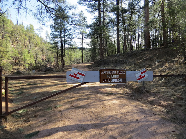
Unfortunately the campgrounds up here don't open until April, or I would have tried to camp here.
 But the trail is open. The first challenge is to cross Horton Creek without getting your feet wet!
 I am back in the land of tall trees....very refreshing!
 Can you smell the pine forest?
You can fish, but you have to release all you catch.
 The water is swift and there are many opportunities to photograph the creek.
 So I did!
 Oh, and lots of beautiful birds! This is a Stellar's Jay.
 I could hear and see many birds that did not want their pictures taken.
 This Raven flew over my head.
 Some birds puzzled me, but I think this is a female Western Bluebird.
 And maybe this is a Pygmy Nuthatch? If so, it's a new one for me.
 Sometimes you could only glimpse the cascades through the trees below.
 A cacophony of Red-shafted Flickers showing off their colorful plumage!
 This is the male with the red moustache.
 This is one of two females.
 The creek spills over numerous limestone ledges...
 Thistle sampled the water a few times.
 Spilling over a large log...


 That's snow on the left...a few patches were seen in shady places. I turned back shortly after this and didn't finish the trail all the way to Horton Spring. We were getting tired and it was another 4 miles back to the car.
 I see on the map a shorter way to get to the spring from another highway, so maybe next time. Meanwhile, I thought this trail was awesome!
 Long shadows...time to go home and rest, and maybe read the Zane Grey novel I picked up at the museum..."Under the Tonto Rim."

Sunday, February 28, 2016

Tonto Natural Bridge State Park

Hidden in a small valley between Payson and Pine, AZ, Tonto Natural Bridge has been in the making for thousands of years.
The discovery was first documented in 1877 by David Gowan, a prospector who stumbled across the bridge as he was chased by Apaches.
Only two of the trails were open due to flooding on the other trails. We started with the Waterfall Trail...it is not your typical waterfall.
 The entire trail is stairs...
 I had never heard the term "travertine" before, but I was about to learn what it meant.
 And I was about to become one with the waterfall...
 Travertine is a light colored calcerous rock deposited by mineral springs. Very slowly, layer by layer, the minerals build up on plant life and turn to stone...and the plants become sort of like petrified wood. You can see roots and mosses that have calcified in this photo.
 Travertine formations hang over the trail.
 We are approaching the area where water is still flowing over living plants.
 At first I didn't realize that this was the waterfall I hiked down to see.
 Eventually the rock will form stalactites and shallow caves.
 And the vines and mosses will become part of the rock.
 The "grotto" is a small cave formed in the travertine rock.
 I suppose if I stood here long enough, I would turn to stone too.
 The waterfall...
 Travertine stalactites forming.
 Old growth...
 The stone I passed on the way down has more meaning now.
And it's a good thing we had this little lesson first, because it makes this information about the bridge much more interesting.
 Tonto Natural Bridge from viewpoint #1. Pine Creek flows through it.
 Close up of the travertine formations.

 Viewpoint #2, from the opposite side of the creek reveals more of the travertine rock. You can see Viewpoint #1 from here.
 Stalactites.
Viewpoint #3 shows the trail to the bottom and under the arch. We'll do that in a minute.
 Viewpoint #4 shows the other side of the bridge. Note the trees on top with the overhanging roots.
Water is flowing down those roots and plants.
 And constantly falling under the arch.
 View in the other direction of the valley.
 The Gowan Trail will take us to the bottom. Be glad you're not being chased by Apaches.
 I met this nice couple from my home state of Vermont going down the trail.
 The bridge we saw from above.
 Pine Creek


 Spring water flows constantly over the edge, and the arch is ever-growing.
 The 400-foot tunnel measures 150 feet at its widest point.
 Colorful lichens and mosses thrive in this moist environment.

 The falling spray creates rainbows that come and go.
 Back up the trail.
 You can do it!