There is only one hiking trail you can do into Canyon de Chelly without a guide, and I got up early to do it while it was cool. This picture is from Tsegi Overlook on the South Rim. The view is of Navajo farmlands on the canyon floor.
I started out at the crack of dawn.
Interesting cloud patterns with the rising sun behind them.
Thistle couldn't come on this hike.
No one else was at the trailhead overlook, except this raven taking in the morning rays.
The trail starts from the overlook along the rim.
The dark crack is where the trail starts its descent.
Trail marker etched into the stone.
And steps carved into the stone.
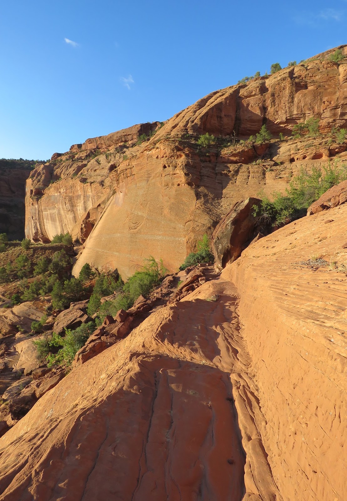
The beginning of the trail down.
Through a tunnel in the cliff.
The first switchback.
Gorgeous day.
The trail below.
Part way down.
Holes carved by erosion.
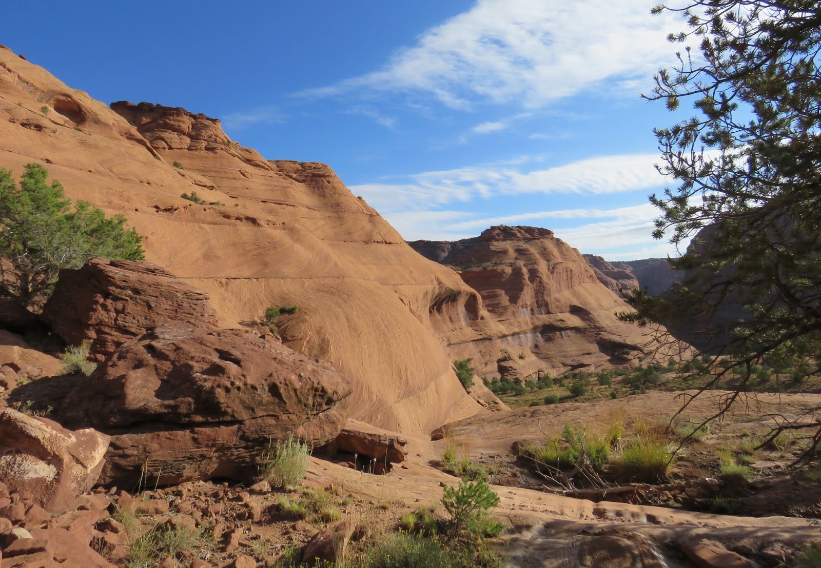
Views along the trail.
First wildlife...a Red-spotted toad.
He thinks he's hiding, and he does blend in nicely with the red sandstone.
Sun coming over the rim.
There's a switchback ahead, but it looked like the trail continues straight. Maybe that is an old trail used by sheep or Navajo.
No fences here.
I made sure my camera lens cap was in place after each photo. I don't want another mishap with the rocks.
Looking back the way I came.
No, that is not the trail.
Nearing the bottom. Trees are growing along the trail.
Checking out the alcoves in the canyon walls.
More wildlife...a bird in that tree.
I don't know what kind.
Almost to the bottom.
Looking back.
I encountered a Navajo man on his way up. Later I discovered that some get their daily exercise this way.
That's me...getting my exercise.
Another tunnel.
That slide area might be faster, but I stayed on the trail.
Through the tunnel.
A Navajo Hogan can be seen as you emerge from the other end.
The last descent to the canyon floor.
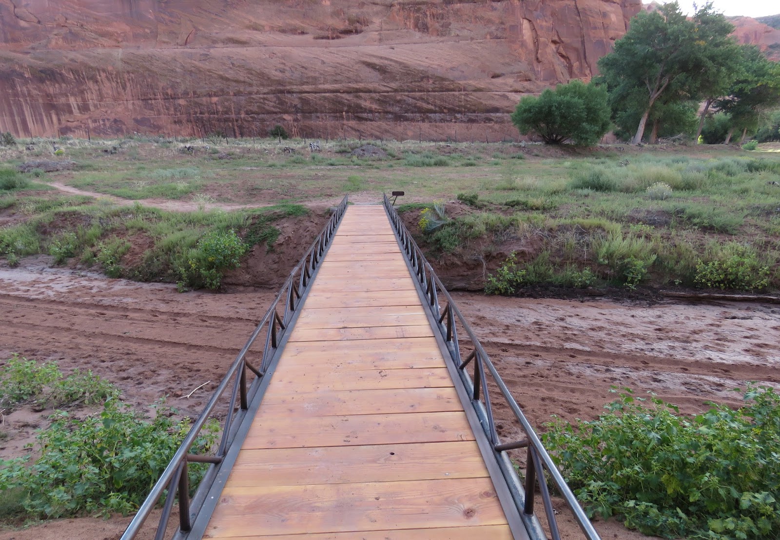
From there you walk through some Navajo farmland to get to the White House ruins.
Jimson weed, medicinal, but hallucinogenic.
Following the trail.
Wildflowers.
A bridge across the wash.
Cactus fruit.
Cottonwood trees.
I see the ruins ahead.
And the facilities!
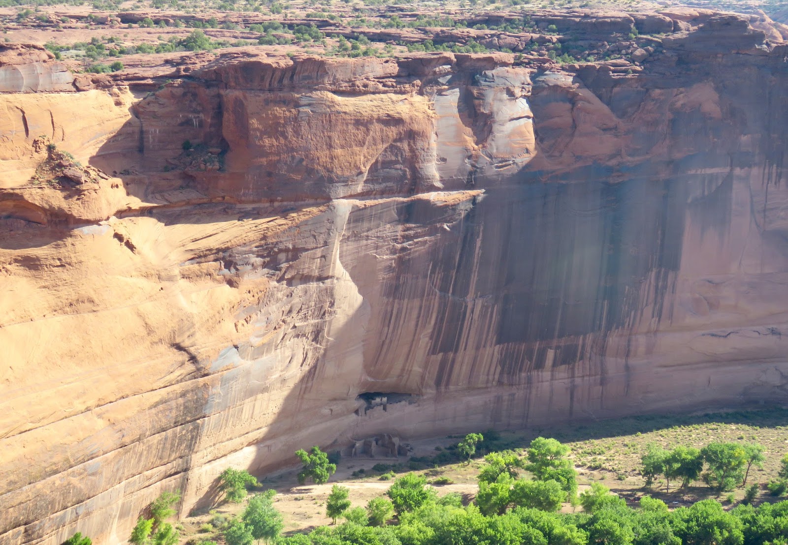
White House Ruins is named for the long, white plaster wall in the upper dwelling.
Ancestral Puebloans built and occupied this dwelling about 1,000 years ago.
Upper dwelling...do you see the petroglyph/pictograph just below it?
There are others nearby.
Lower dwelling
When I zoomed in, I could see graffiti on the white plastered wall of the upper dwelling. Notice the dates!
It makes sense that they have a fence around the area now, and that guides are required to go anywhere else inside the canyon.
I also discovered more rock art by zooming in.
Another angle view of White House Ruin.
Maybe a turkey?
More wildlife...a spotted ground squirrel on the lower dwelling.
Navajo vendors were selling jewelry here. I bought my granddaughter a bracelet for her birthday. Then it was time to climb back up.
This lizard is perfectly camouflaged against the red sandstone.
Back through the tunnel.
There's more sun at the bottom and less glare. Makes for better pictures.
Views from the climb.
Looking down into the canyon.
I noticed more (recent) graffiti on the walls of the canyon. Too bad.
No wonder they don't want people in here without a guide.
Although some of it may be done by the Navajo themselves. The name Redhorse makes me think that.
Looking down.
And looking up...
Back to the tunnel at the top.
A different kind of lizard blending with the gray rock.
These are views from White House Overlook, now that the sun is fully up.
An old hogan.
The ruins can be seen just inside the shadow on the opposite wall.
Zoomed in.
Looking in the other direction I can see another ruin.
I think it may be Junction Ruin that I saw on my horseback ride.
Granary near Junction Ruin.
Most of the local Navajo now live up on the rim.
Another old hogan and horse corral or other livestock shelter on the canyon floor.
Using my binoculars I discovered another small ruin near the White House.
Not sure whether it was a dwelling or used for storage.
Small ruin on the left, White House Ruin on the right.
Raven riding the thermals.
Getting a drink from a puddle on top of one of the rock formations.
I drove the rest of the South Rim to more overlooks. This is called Sliding House Ruin... in the alcoves just below the rim.
More views from there. The ruins are hard to spot without binoculars, but are usually found in the dark shaded horizontal "cracks" in the canyon walls.
Zooming in on a crack.
And there is a ruin.
They are well disguised.
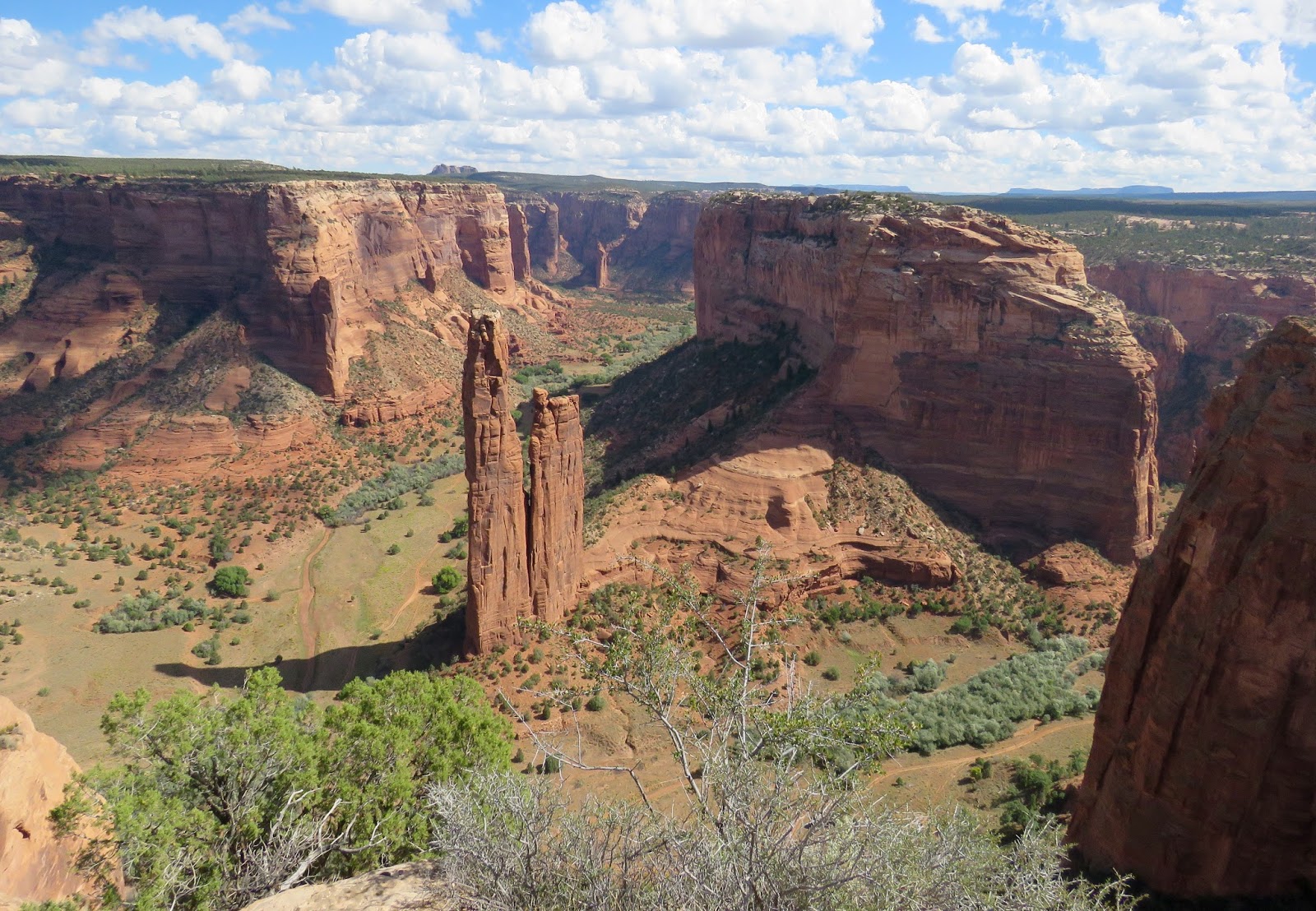
This is Spider Rock Overlook. There are no signs, so you have to guess which is Spider Rock. I thought that spire in the middle was it at first.
Until the larger spire came into view in front. That's Spider Rock. It is an 800-foot sandstone spire that marks the junction of Canyon de Chelly and Monument Canyon.
And if you zoom on its base, there is a ruin there.
Spider Rock
From here you can see the volcanic core of Black Rock Butte.
Black Rock Butte
View from the overlook up Canyon de Chelly.
Canyon de Chelly on the left; Monument Canyon on the right.
Another old hogan can be seen in Monument Canyon.
More views from the overlook.
Another overlook called Face Rock. There are more ruins near the rim.
I never did figure out the significance of the name Face Rock. But I found more ruins below by searching the shadowy "cracks."
There are over 200 identified ruins in the canyons. Most of them are not labeled on the map you are given.
So you have to keep searching those dark areas.
There's another one.
Amazing when you think about it.
You know where to look now.
This last picture is called Tunnel Overlook...back near my campground.
Definitely worth a visit, and most definitely worth a tour. I think next time I'm here I will take a vehicle tour so I can go farther into the canyon.